As part of KG RESILAND project, the Ministry of Emergency Situations of Kyrgyzstan received digital terrain models for 14 priority areas, covering a total of around 6,000 hectares with a resolution of up to 3 meters.
According to the ministry’s press service, the new maps will enable precise analysis of the terrain, identification of vulnerable zones, and modeling of hazardous natural processes such as mudflows, floods, and landslides.
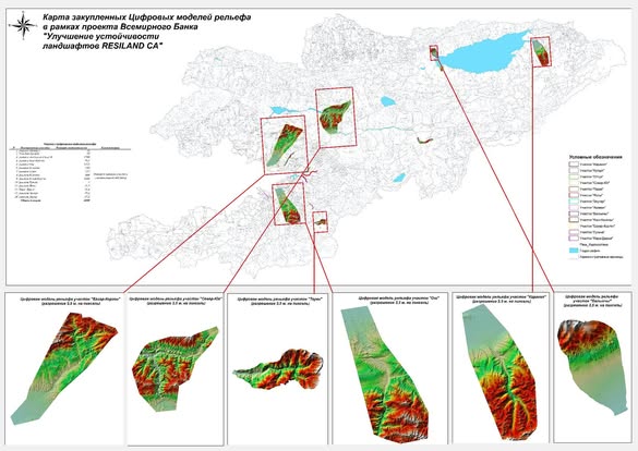
Digital terrain models are created using aerial photography, satellite data, and geodetic measurements, allowing a shift from descriptive analysis to accurate calculations and forecasts.