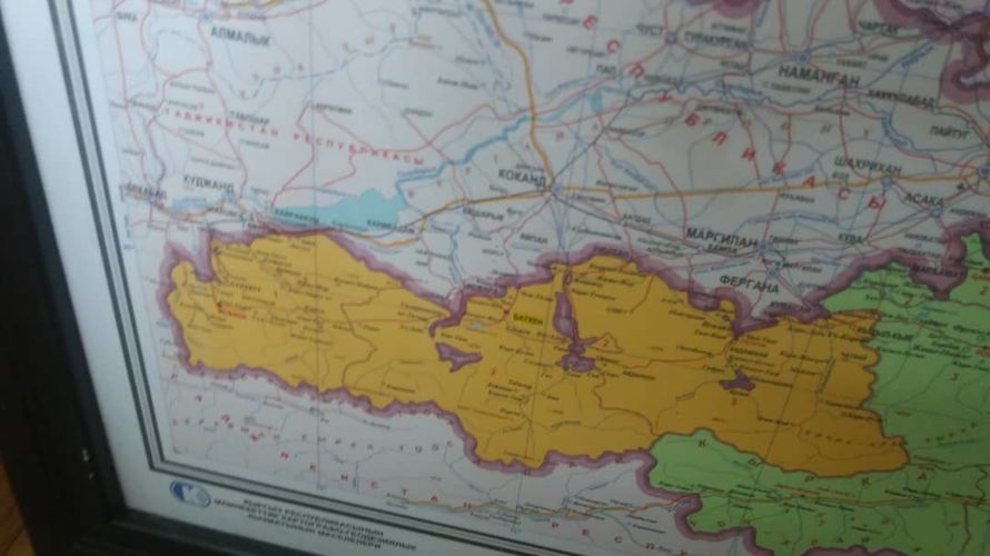
A scandal around map, where Vorukh enclave is annexed to Tajikistan, erupted in Kyrgyzstan. It was hanged at Ala-Archa-1 state residence on November 20 at an event to mark the professional holiday of employees of the prosecution bodies.
The President Sadyr Japarov made a speech and presented awards to the employees of the supervisory authority against the background of the map with the gross mistake. Photos from the event were first published on the official page of the head of state, and later removed.
24.kg news agency decided to find out what the enclaves located on the territory of Kyrgyzstan look like on the maps of different states.
Not the first case
When the scandal began to gain momentum, the Prosecutor General’s Office said that the executors were to blame — they ordered the banner from a private company, and promised to punish those responsible for organizing the event.
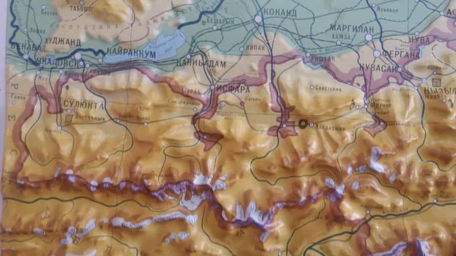
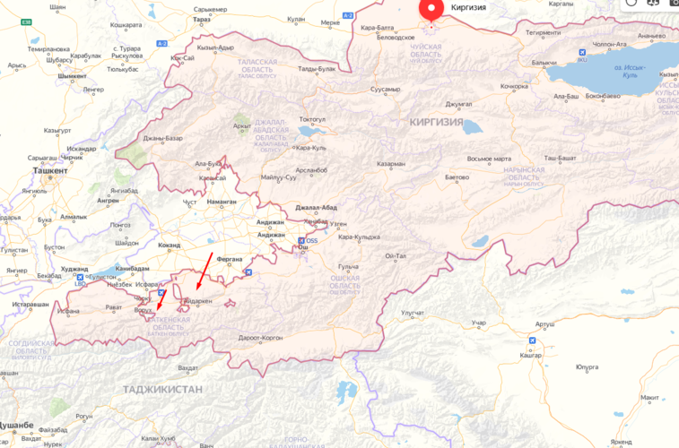
As it is known, there are four Uzbek enclaves and two Tajik ones on the territory of Kyrgyzstan. They are located near the state border and disputed areas, where the process of delimitation and demarcation has not yet been completed.
This is not an isolated case when the location and outlines of the enclaves are shown incorrectly. It also became known that the map with the enclaves is also distorted in Homeland Studies school textbooks. The Ministry of Education said that they know about the problem, but apparently they are in no hurry to solve it.
Authorities don’t react
Apparently, not only ordinary citizens, printing houses, but also official bodies, such as the Prosecutor General’s Office, are unaware of the existence of the State Cartographic and Geodetic Service, which stores officially approved maps of Kyrgyzstan not only of different years, but also of different types.
«Vorukh is not annexed to Tajikistan in any map of Kyrgyzstan. This is mistake. We can provide all the maps of Kyrgyzstan, where not only Vorukh, but also other enclaves located on the territory of Kyrgyzstan are clearly outlined,» the Deputy Director of the State Cartographic and Geodetic Service Abdymalik Murzaev said.
In accordance with the law on geodesy and cartography, the service supervises the correct display of the state border, but a few people turn to specialists before printing a map of the country.
The leadership of the cartography service has repeatedly appealed to the State Committee for National Security with a request to take action against those who use an incorrect image of the country’s territory. But the authorities do not respond.
«The territory of the country was incorrectly depicted in a magazine; we wrote a statement to the State Committee for National Security. We also know about the textbook, we have contacted the relevant services, and it should have already been removed. One of the banks recently made the same mistake, we warned them. People take a map from unknown resources and print it as they want. Unfortunately, we can only conduct supervision, we do not have a punitive function,» Abdymalik Murzaev said.
Other sources
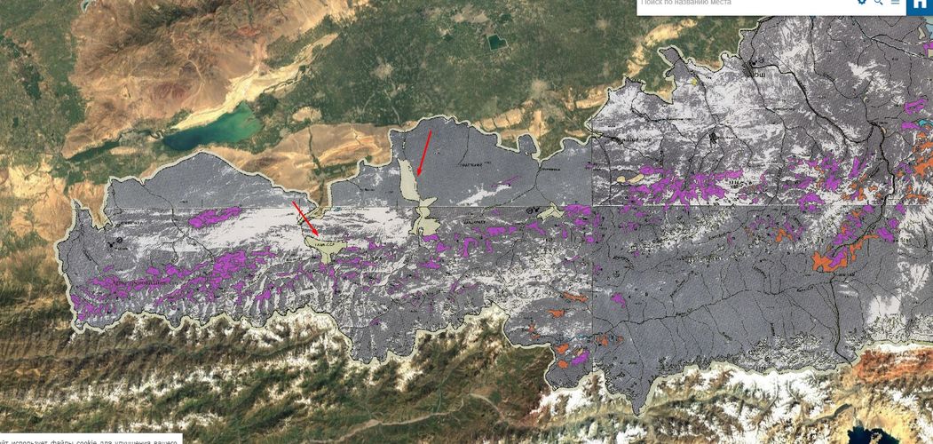
Six enclaves are marked on the territory of the Kyrgyz Republic even by Google map service. All of them are separated from neighboring states. It is not known where the notorious customers referred to by the officials of the Prosecutor General’s Office took the distorted map.
«It is unclear how some printing houses manage to show their illiteracy in such a way,» employees of the cartography service note.
Considering that the issues with the enclaves have not yet been resolved, experts urge to use the map of the country with caution and check it for reliability. Such errors, even if they do not affect the delimitation and demarcation processes, can cause a public outcry.
Note to government bodies and organizers of events at the highest level with participation of the President: there is such a website as kyrgyzmap, where you can easily find different types of official maps of the Kyrgyz Republic.
Vorukh — exclave on the website of the President of Tajikistan
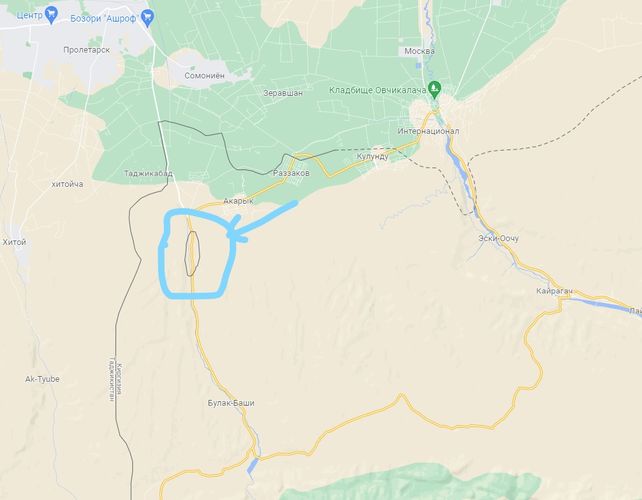
In almost all Internet sources Vorukh is marked as an enclave in Kyrgyzstan, even on historical maps. But in order to see it well, you just need to enlarge the map.
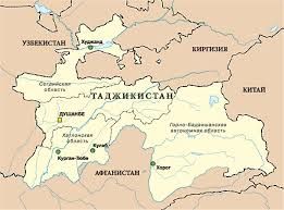
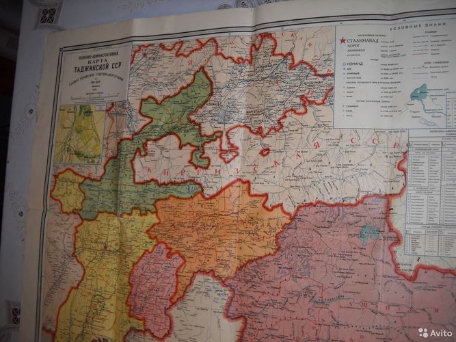
Only on the map of Tajikistan dated 1939 Vorukh is annexed to the Republic of Tajikistan.
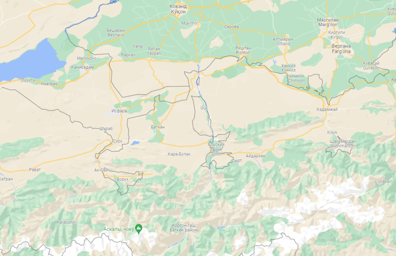
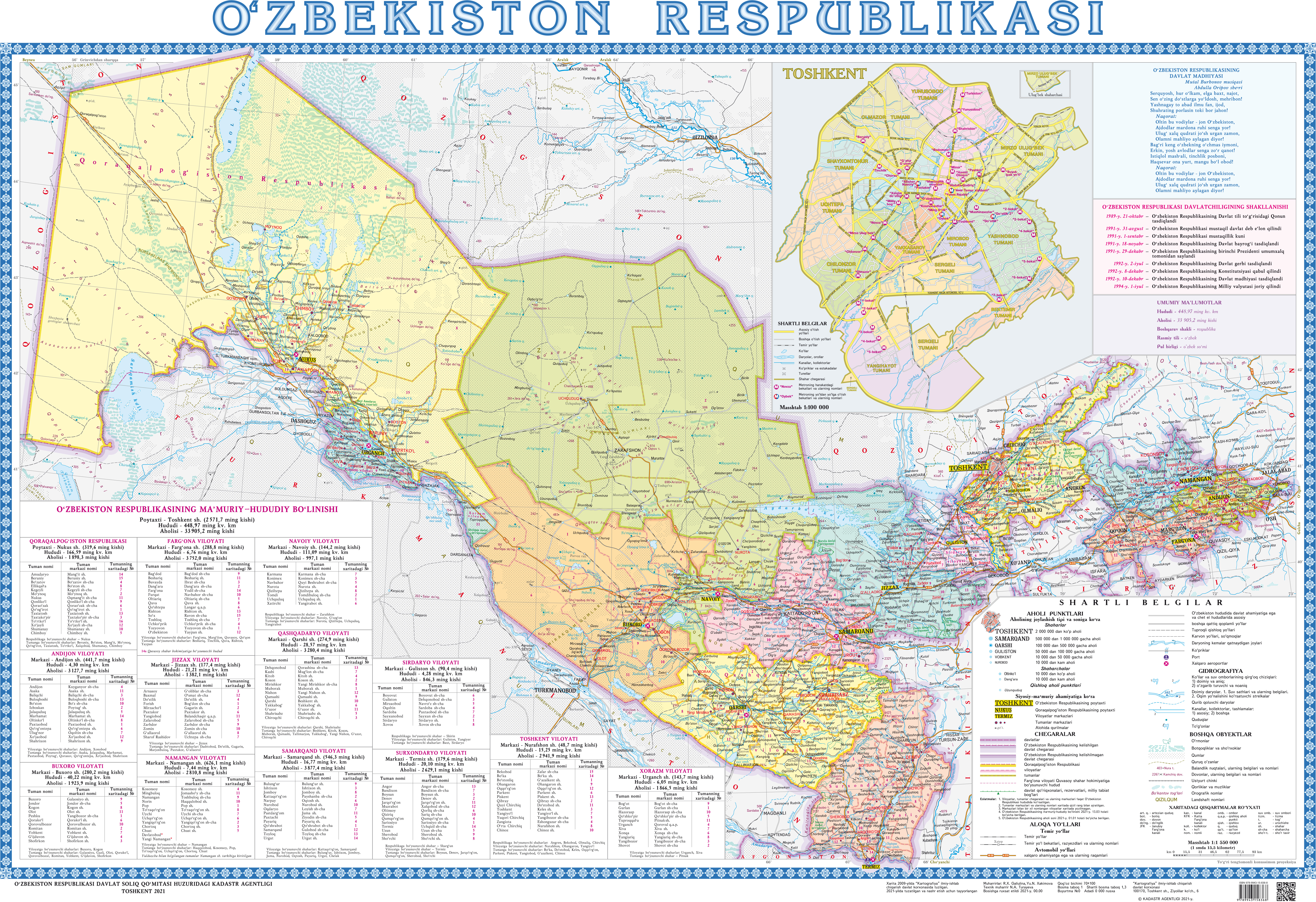
Four Uzbekistan’s points in the Kyrgyz Republic
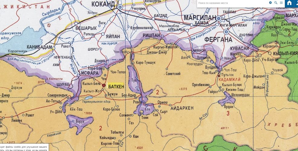
The largest enclave in the Kyrgyz Republic is the Uzbek Sokh, then Shakhimardan. They can be seen on all maps and are located in Batken region. The other two are smaller, they can only be seen by enlarging the maps.
However, there are maps on the official pages of the leadership of Uzbekistan, where their exclaves on the territory of the Kyrgyz Republic are not displayed.
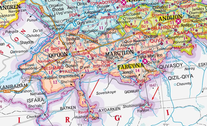
On the website of the State Committee for Land Resources, Geodesy, Cartography and State Cadastre of Uzbekistan, you can download political and administrative maps, where Sokh, Shakhimardan, Chon-Gara and Dzhangal are clearly indicated. They are separated from the territory of the Republic of Uzbekistan.
It is a mystery where the Prosecutor General’s Office of Kyrgyzstan and the customers found the map with distortions.


